


11 September 2024
Collaborating for Enhanced Resilience: Maritime Example
Written by Elena kolosova
Discover how Interreg Baltic Sea Region projects are revolutionising maritime safety. Such innovative approaches are essential for ensuring safe navigation in the Baltic Sea. With these efforts, we also support the aspirations of the EU Strategy for the Baltic Sea Region (EUSBSR) in making the Baltic Sea region a model for sustainable shipping. See you in Visby at the EUSBSR Forum!
Safe Navigation is a Must!
Interreg Baltic Sea Region projects are enhancing sea navigation safety by developing next-generation navigational products and services that comply with new international standards. Project partners are advancing safe shipping by digitalising navigational charts in the Baltic Sea e-Nav project, establishing a new height reference system in the BalMarGrav project, developing alternative positioning services in the ORMOBASS project, and creating new risk assessment and management tools in the OpenRisk II project.
Project Highlight: The Baltic Sea e-Nav
| The Baltic Sea e-Nav project is shifting the paradigm of ship navigation by fully digitalising navigational charts. Imagine upgrading from an early 2000s car navigator to the sophisticated, user-friendly Google Maps—this is what moving from today’s standards to the new S-100 standards means for sea navigation. With these advancements, navigators can plan more energy-efficient routes, avoid safety risks, and consider environmentally sensitive areas. The project partners started this exciting three-year journey in November 2023, implementing S-100 standards ratified by the International Maritime Organization into navigation products and services. Expect a lot of prototyping, testing, and piloting as the project moves towards harmonized navigation products that ships |
can use almost seamlessly across international waters – a common necessity in the Baltic Sea. What are those magic S-100 standards and products that Baltic Sea e-nav work with?
|
Important for the EUSBSR
The solutions developed by these projects advance the EUSBSR policy areas Ship and Safe in their mission to make the Baltic Sea region a model region for sustainable shipping. Together, project partners and the coordinators of the EUSBSR policy areas ensure that our region can function as a test-bed for new and innovative products, services, methods, and practices addressing global challenges.
The Coordinator of the EUSBSR Policy Area Safe, Ulf Siwe, Swedish Maritime Administration, stated:

Projects are the main tool to realise the objectives of the EUSBSR Action Plan. For example, Baltic Sea e-Nav helps PA Safe to obtain the actions ‘Providing reliable navigational conditions to the Baltic Sea’ and ‘To be a forerunner in digitalisation and automation’ as well as PA Ship’s ‘Support measures including digitalisation in reducing emissions from shipping’.
The project results are essential to drive policy changes. The Baltic Sea e-Nav project helps EU Member States implement the Under Keel Clearance policies among the first in the world, which will mean that ships can load more goods and increase safety margins at the same time.
The Coordinators of the Policy Areas Safe and Ship assist project partners with the definition of a change strategy and further implementation of the developed solutions after the projects conclude. We also disseminate the project results and use them to stimulate new project ideas taking concepts even further.
Explore other projects enhancing maritime safety:
- The MaDaMe project develops digital fairway services and cyber secure communication for maritime authorities to efficiently share navigational information and increase safety at sea.
- To ensure safer navigation at the Baltic Sea, the project ORMOBASS introduces a terrestrial R-Mode system that replaces global navigation satellite systems in case of disruptions, and warns ships about increased navigational risks.
- The project OpenRisk II equips maritime authorities and intergovernmental organisations with the risk assessment and risk management tools and thus helps to minimise maritime accidents and their footprint on the marine environment.
- The project BalMarGrav harmonises data on the Earth’s gravity across the region to feed it into a new height reference system for safer navigation, offshore infrastructure and sea traffic management.
Meet the Interreg Baltic Sea Region Programme and the EUSBSR Policy Area Innovation Coordinators in Visby on 30 October 2024 at the Annual Forum of the EUSBSR:
- Time: 11:00-12:30, Panel discussion “Financing Cooperation in the Baltic Sea Region”: meet the Programme and the BSI_4Women representatives who will share experiences in developing solutions for the Baltic Sea region and connecting them to the EUSBSR.
-
Time: 11:00-12:30, Workshop “Inclusive Work Environment – Tools to Build Gender Equality” is relevant for all industries. In shipping an inclusive work environment also increases the safety!
- Time: 16:30-18:00, Workshop “Have Your Say on Interreg Funding in the Baltic Sea Region After 2027”: join us and help shape the future of Interreg cooperation in the Baltic Sea region.
-
Time: 16:30-18:00, in the workshop “Aligning Cross-Sectorial Efforts to Reach Policy Goals on Saving the Sea” you will learn about the cooperation of EUSBSR with other policy affecting organisations like HELCOM and VASAB.
Register NOW!
Meet us and other EUSBSR stakeholders in the Networking village during both days of the EUSBSR Forum, on 30-31 October 2024. Registration to the EUSBSR Forum is open at https://eusbsr.eu/annual-forum/registration-inquiries/.
More recent news
From achievements to ambitions: shaping the future Interreg Baltic Sea Region
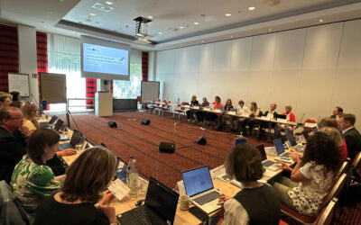
While the current Interreg Baltic Sea Region Programme is delivering results across the region, preparations for the next Programme are already gaining momentum. This dual focus was at the heart of the Monitoring Committee meeting held in Berlin on 9–10 June 2026.
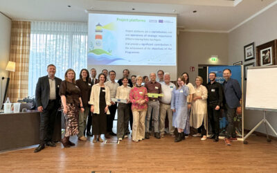
High five: new project platforms onboard!
Five strong transnational partnerships, five strategic topics addressed, and endless opportunities to showcase the power of Interreg: the new project platforms, designated as Operations of Strategic Importance, met for their kick-off meeting in Berlin on 9 June.

Designing the future Programme, together with cities and regions!
Tallinn, 11 May, may have appeared in many calendars simply as “BSSSC Day of Regions and Cities”. In reality, the day marked an important moment in shaping the future of the Interreg Baltic Sea Region Programme. What made it special? Cities and regions took centre stage!
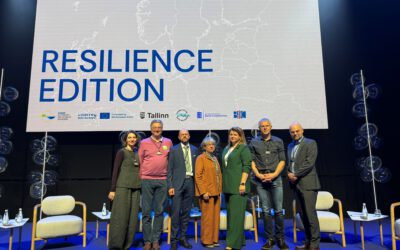
When crises stop being exceptions: what resilience really meant at the EUSBSR Annual Forum 2026
26 May 2026 When crises stop being exceptions: what resilience really meant at the EUSBSR Annual Forum 2026 Written by Anna ZaccaroFor years,...