




Kalundborg, Denmark
21 November 2024
Kalundborg is an active port city on the west coast of Zealand, Denmark, by the Great Belt. Currently housing 48.000 residents, the municipality is bound to grow substantially over the next few years due to its ever growing industrial presence, as well as an equally growing student population. Albeit a relatively small municipality, it already presents severe congestion issues on its surrounding road network. Promoting alternative modes of transport along with its growth is thus a must for Kalundborg.
BATS partner Kalundborg Municipality has focused on persuading commuters from the surrounding area to switch from the car to the bike, and to keep cycling all year round. Within the BATS project, the municipality worked to close a “missing link” in its cycle network and to make cycling a safe and natural choice even through the dark winter months.
Lighting and metro-map wayfinding along the ‘missing link’
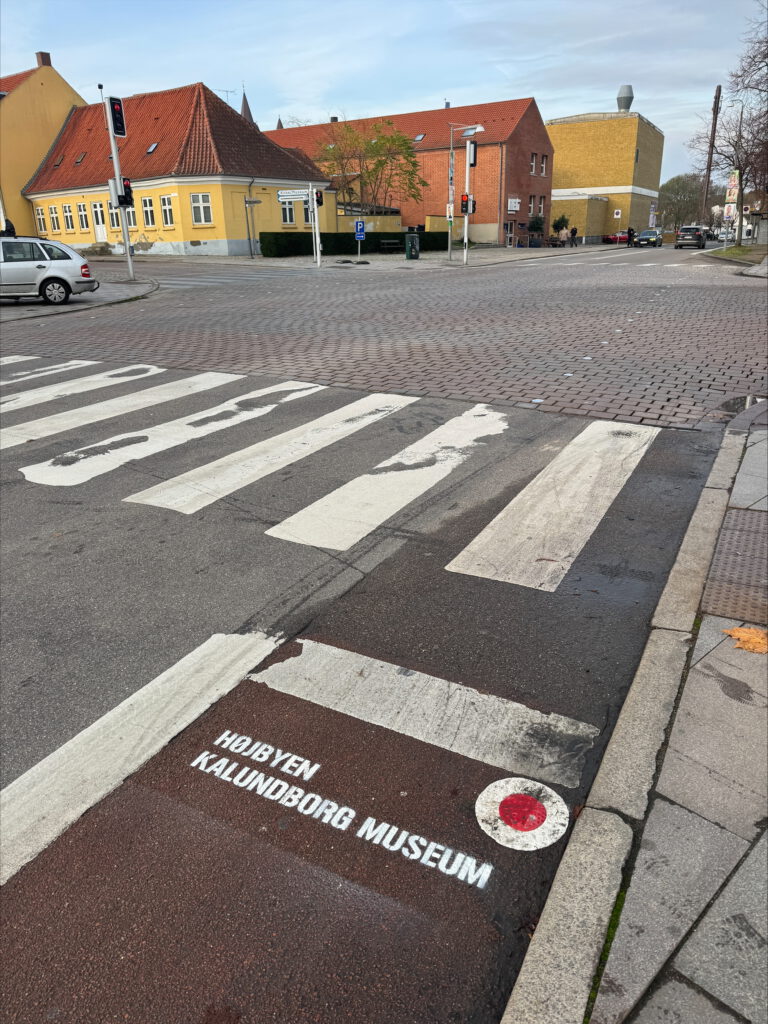
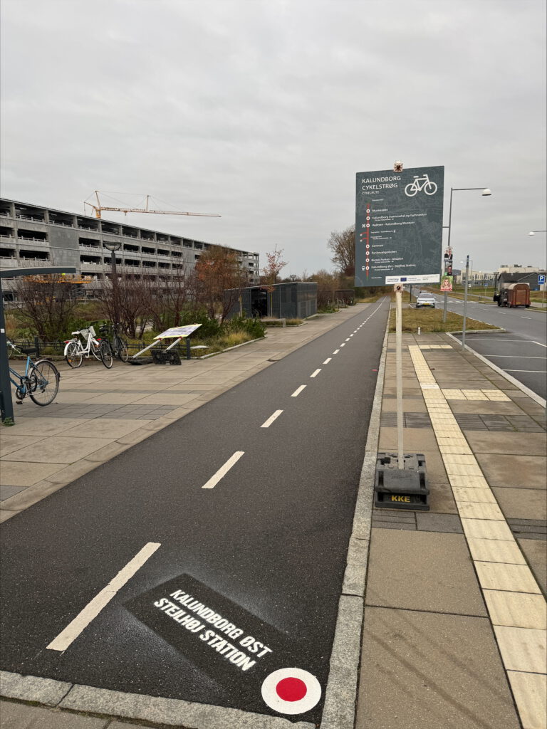
A short but poorly lit stretch along Rynkevangen, on the connection between Kalundborg City and the Biotech City Campus, was a weak point in the network: it felt unsafe in the dark and steered cyclists past an accident-prone shared roundabout. Rather than install expensive, grid-connected lighting, the municipality lit a roughly one-kilometre corridor with 26 movable, solar-powered light poles, which could be deployed quickly and relocated to try out different routes. On top of the lighting, Kalundborg added a wayfinding layer it called the Kalundborg Cykelstrøg: a “metro map” placed at several points along the route, presenting the city’s main hubs as if they were stops on a metro line from Station Øst to Munkesøen, with red dots painted along the ground to guide riders and the name of each “stop” marked where they arrived. The markings used a special paint that was cut and heated into the surface (rather than sprayed on), which also added grip.
Citizen engagement was built into the experiment from the very start, and structured so that each phase fed the next. It opened with a baseline online survey at the end of 2024, and doubled as the recruitment channel for a volunteer test group. Once the lighting and wayfinding were in, said test group rode the upgraded route in real conditions, and the municipality followed up with 20 to 30 minute phone interviews to hear how they found the lighting, the markings, the sense of safety and the usability of the new lane. Parallelly, the municipality ran a campaign promoting the new connection.
Results & Lessons. The baseline survey confirmed that infrastructure quality and safety weigh heavily on how people choose to travel: many respondents depended on their cars, but a good number said they would cycle more if the infrastructure improved substantially. Once the “missing link” route was upgraded, cyclists said the lighting made them feel noticeably safer from traffic and helped them navigate in the dark.
The solar poles were cheap and quick to deploy, but their light output was modest and was further dimmed by light pollution from nearby street lighting. The wayfinding also needed to be clearly explained so people understood the metro-map idea, and the test group pointed out that the ground markings should have been blue (the colour Danes associate with cycle signage) rather than red.
A wider lesson concerned the engagement itself: pairing a broad survey with a small group of interviewees generated both broad and detailed feedback, but it pays to recruit the test group with a surplus (drop-off is likely) and to combine data types (numbers from surveys, depth from interviews) to build a fuller picture. Movable, off-grid lighting also proved its worth as a low-commitment way to test a route before any permanent investment.
Retrofitting protective elements at Elmegade
As part of retrofitting the stretch between Elmegade and Bredgade for cycling, Kalundborg planned to add protective elements to give cyclists more separation and protection from motor traffic (which is quite present on that road), and to learn how well such elements perform (and survive) once winter and its snow-clearing machinery arrive. The intervention suffered delays due to challenges in obtaining permission and due to the harsh 2026 winter forcing works to be postponed to Spring (ironically).
Results & Lessons. Timing was itself the first practical takeaway: on a route redeveloped for year-round cycling, the elements have to be planned around the maintenance calendar, not bolted on regardless of season. Regarding the impact of the intervention, road interviews revealed that while most cyclists did notice the reflective elements (78%), most also stated that the they did not improve the feeling of safety or visibility (84%).

Interactive map showing pilot locations. Use the arrow keys to move the map view and the zoom controls to zoom in or out. Press the Tab key to navigate between markers. Press Enter or click a marker to view pilot project details.
Additional links
details
-
Homepage
-
Project typeCore Project

-
ImplementationNovember 2023 - October 2026
-
StatusOngoing
-
Contribution to EUSBSRPolicy Area Transport

-
Target groups
- Infrastructure and public service provider
- Local public authority
- Regional public authority
-
Social media
-
Additional links
-
Tags