

Challenges we encountered and overcame: The Baltic Sea e-Nav story so far
19 May 2026
They say innovation is hard to predict. In the Baltic Sea e-Nav project, funded by the Interreg Baltic Sea Region program, we’ve gathered hydrographic offices, meteorological institutes, academia and maritime tech providers around the Baltic to develop a new generation of digital navigation products.
The maritime world is moving from older chart formats (the long-serving S-57 standard) to a new family of digital products for electronic navigation called S-100. Under that umbrella, S-101 covers electronic charts, S-102 high-resolution depth data, S-104 water level information, and S-111 surface currents. What we’ve set out to do in this project is to test, refine and harmonize these products across the region so that mariners get the same experience regardless of where in the Baltic region they are sailing. Together, these products will give the officer on the bridge a richer, more interactive picture of what is around and beneath the ship, modernizing navigation as we’ve known it for the last 30-40+ years.
As our project draws to an end, let’s have an honest look at what went sideways, the lessons learned and how we handled it when things didn’t go exactly to plan
Starting messier than expected
By the time the project launched in November 2023, it was already clear that the original work plan would not survive contact with reality.
Firstly, the initial plan for harmonization was for an external commission to deliver draft guidelines that we would then refine. However, since our timelines didn’t align, we had to start the harmonization effort ourselves and start a year earlier than planned to provide guidance for dataset prototyping.
Secondly, some partners were ready to start producing test datasets but the technology providers developing the navigation system prototype wanted real, stable specifications to know what to build for. Developing the prototype based on draft specifications posed the risk of doing the work twice, paying for it twice, and possibly testing the wrong thing. So, we decided to wait for the operational versions of the standards. It was hopefully the right call, but it meant the later parts of the project would be much busier than originally planned, as the decision pushed the testing phase back by about six months.
Waiting for the world to catch up

Partner meeting in Rauma, 10.4.2025
If our project start was about adjusting to reality, project period 2 was about being patient with it.
The IHO’s own timeline for releasing operational versions of the standards slipped to December 2024. That meant our partners could not start producing data in those final formats until early 2025, which in turn meant the simulator-based pilots had to wait too.
While waiting, we held our breath about something else. The production software that several of our hydrographic-office partners use comes from two third-party providers. Both needed to update their software to handle the new standards. and while one confirmed it would deliver on time the other doesn’t expect to deliver until summer.
Harmonization continued to prove challenging, mostly because three of the four standards are genuinely new. You cannot really harmonize something properly until you have seen how it behaves on a real chart-display system. We could write theoretical guidelines, but we would not know whether they made sense in practice until the pilots ran. Drafts went around, feedback rounds took place, and we held workshops on what harmonization should even mean for water-level and current information.
First pilots, mixed results
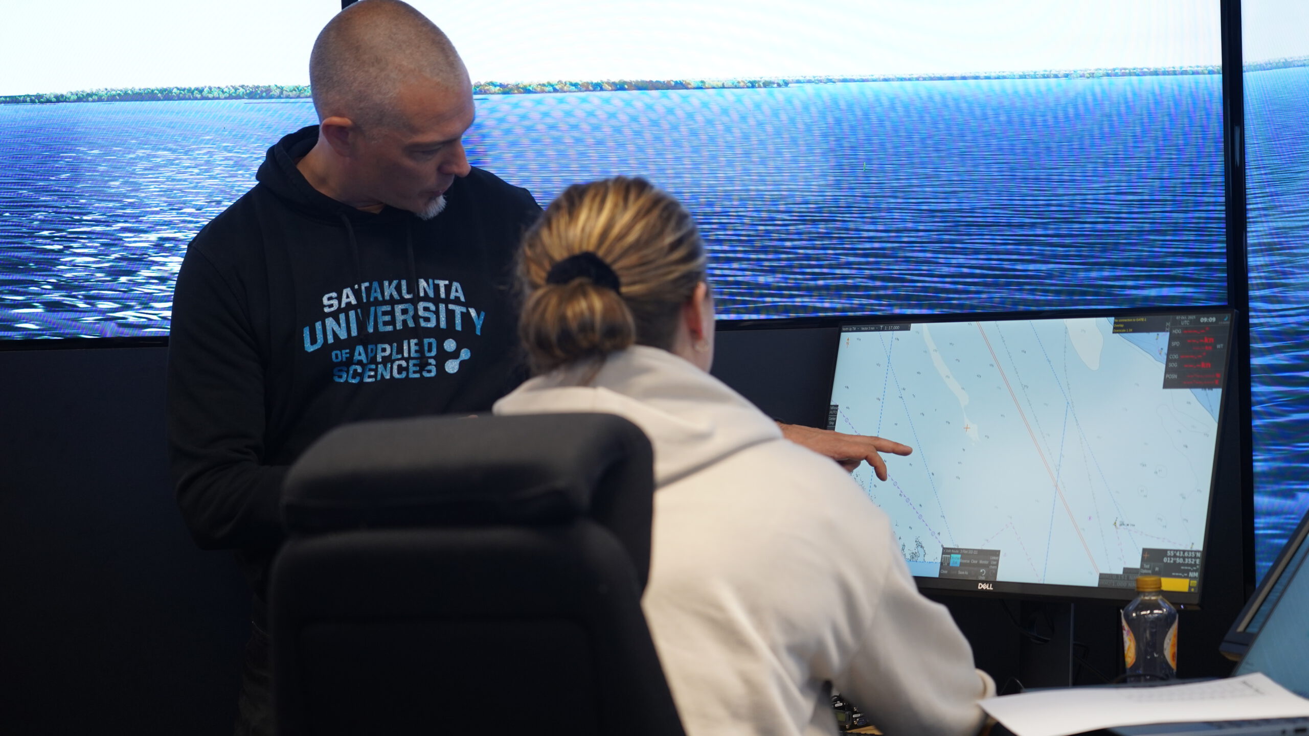
Once the first version of the navigation system prototype had been built and could read and display the new data formats, it was time to start testing in full-mission bridge simulators with real mariners at the controls
Almost. The prototype did not yet support the water-level and surface current standards, which delayed testing of those products. There were also some visual bugs; little display glitches that, if not explained properly to the test pilots, could have skewed the feedback. We worked around both, but were then forced to compress the testing window more than we had hoped. Despite this, the first round of pilots ran successfully. Active mariners, students, lecturers and industry professionals took turns at the simulator, ran through scenarios, and gave us their unvarnished views.
Pilot Round 2, 2025
Harmonization, meanwhile, sprinted ahead. Guidelines for electronic charts and high-resolution depth data were endorsed in spring and adopted by the regional hydrographic commission in autumn 2025, actually slightly ahead of plan. Work on the water-level and surface current guidelines continued in close cooperation with the meteorological institutes around the region, and drafts have now been completed, with a version 2.0 targeted for adoption in autumn 2026. Remaining work on harmonization is managed within BSHC working groups.
Settling into a rhythm
Come November last year, the project had found its stride and we completed a second round of pilots. The navigation system prototype now included some support to display water level adjustment and surface currents, although some technical issues remained around how forecast data is formatted so it can be overlaid neatly on the chart. This time the simulators included the full suite (charts, depth data, water levels, currents) and the mariners could explore how the four would work together when you are planning a route or monitoring a passage. The system performed substantially better than in round one.
Early March, we deployed a Navigation System Prototype aboard Wasaline’s M/S Aurora Botnia on the Vaasa–Umeå route, marking the first practical application of S-100 standard navigation products in the Baltic Sea, as part of our third and final round of pilots.
With a little less than six months to project end, we’re making significant progress towards launching the first products in the new family of digital navigational services in the Baltic region, but it hasn’t been straightforward. Perhaps the most important lesson learnt is this: when the technology you are building on is itself still being built, expect waiting and keep your cool. The IHO’s S-100 implementation runs through 2029. We are part of that wave, not separate from it.

Additional links
details
-
Homepage
-
Project typeCore Project

-
ImplementationNovember 2023 - October 2026
-
StatusOngoing
-
Contribution to EUSBSRPolicy Area Safe, Policy Area Ship

-
Target groups
- International governmental organisation
- National public authority
-
Social media
-
Additional links
-
Tags