

Cēsis combines data, pilots and community insights to support mobility planning
22 June 2026
As part of the Interreg Baltic Sea Region project SUMPs for BSR, the municipality of Cēsis has been testing practical ways to strengthen evidence-based mobility planning. Cēsis is participating in the project alongside with Turku, Gdynia, Gävle, Greifswald, and Panevėžys.
Rather than making large infrastructure investments based on assumptions, the municipality has been implementing a range of pilot measures – temporary bicycle lanes, secure bicycle sheds on pilot areas, Al-powered traffic monitoring, a large-scale modal split survey and a city-wide audit of bicycle parking to build a solid evidence base for future planning decisions.
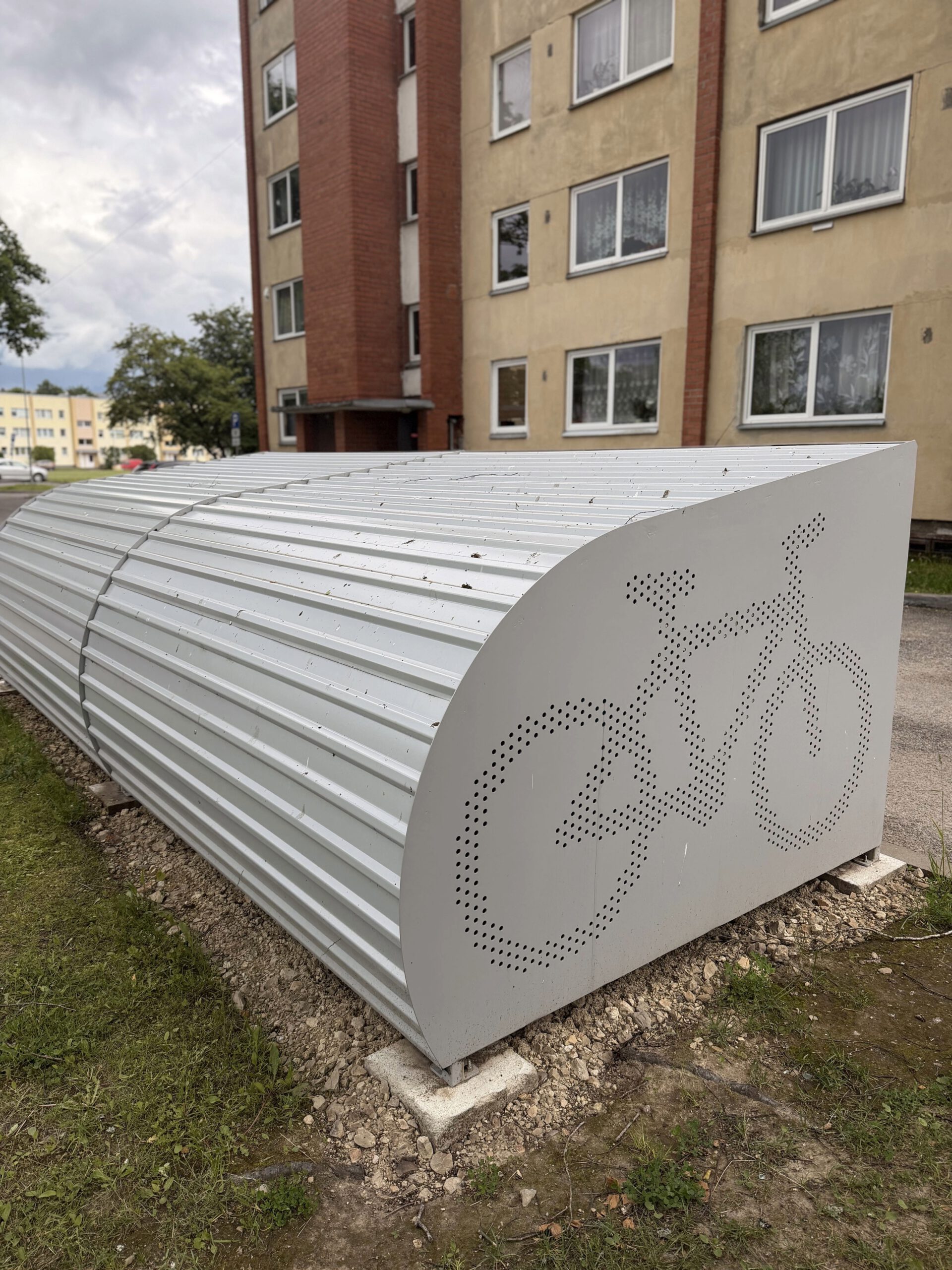
Bicycle sheds in Priekuļi village. Photo: Cēsis municipality.
Counting and classifying active mobility
One of the key lessons from the project is that traditional traffic counts alone do not provide a complete picture of urban mobility. If only vehicles are counted, pedestrians, cyclists and other active mobility users remain largely invisible in the data, making it more difficult to reflect their needs in planning decisions.
To address this challenge, Cēsis installed AI-powered machine vision cameras at several locations across the city. The sensors anonymously count and classify different road users, generating continuous data on mobility patterns and helping planners better understand how public space is used. All data is processed in aggregate form and complies with privacy requirements.
The collected information has already been used to evaluate pilot measures. One example was a summer initiative that restricted car access on weekends in part of the historic town center. Traffic monitoring helped distinguish between local and through traffic, providing an objective basis for discussion and decision-making.
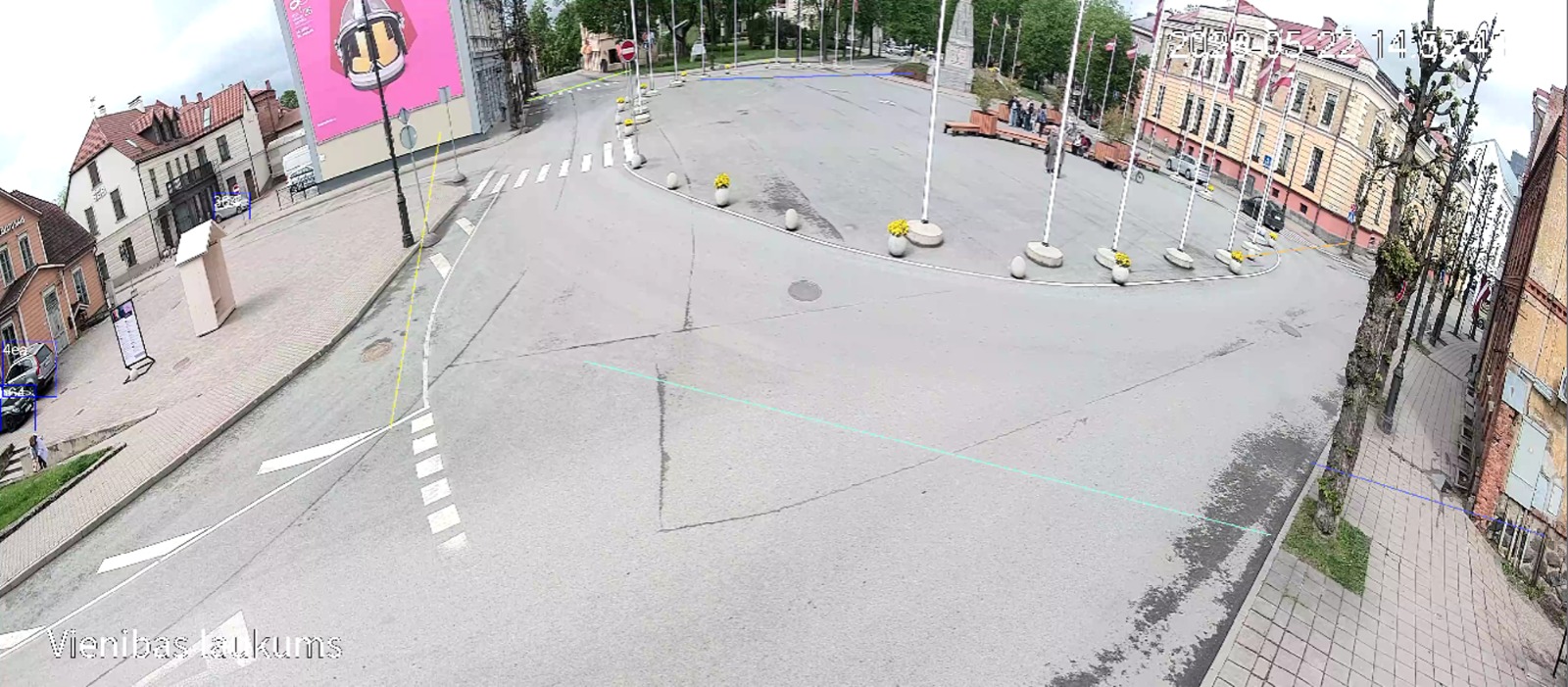
AI-powered machine vision cameras view of the city center, Vienības laukums. Photo: Cēsis municipality.
Modal split survey – establishing a mobility baseline
Alongside traffic monitoring, Cēsis commissioned a resident travel habits survey covering both the city and surrounding villages. Conducted through face-to-face interviews, the survey mapped out how people move around the region in their daily lives: by foot, bicycle, car, or public transport.
The results provide valuable input for the municipality’s transport development planning and help identify where improvements to active mobility and public transport can have the greatest impact. The survey also highlights how strongly travel choices are influenced by the availability and quality of infrastructure.
Testing bicycle lanes before building them permanently
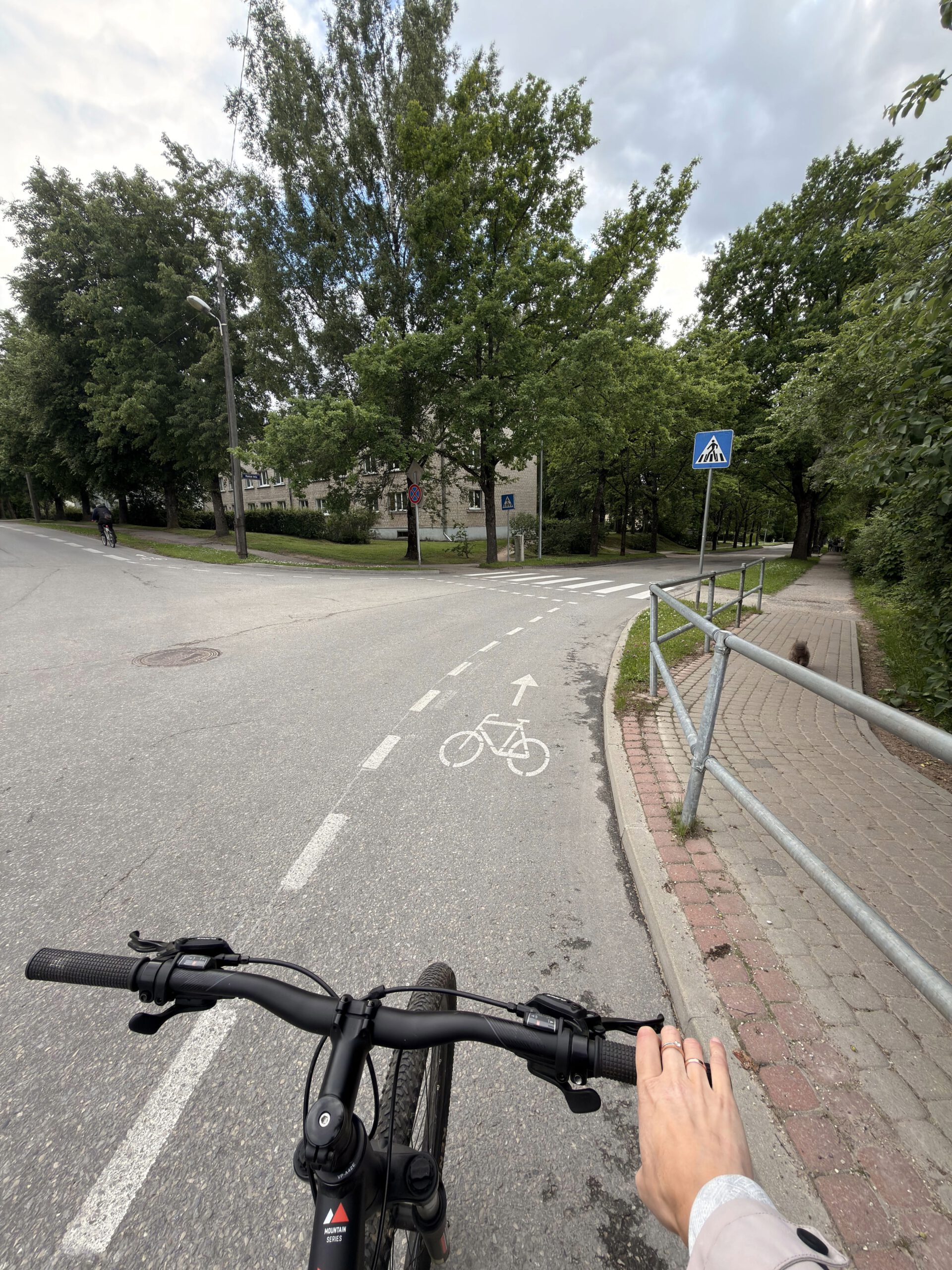
Temporary bicycle lane on Raiņa/Zvirbuļa street. Photo: Cēsis municipality.
The first temporary bicycle lane markings appeared on Cēsis streets in autumn 2025 and were expanded in 2026, following unanimous support from the municipal Traffic Safety Commission.
The pilot approach allows the municipality to observe real-world usage, gather feedback, and evaluate how the changes affect connectivity between residential neighborhoods and the city center. Temporary solutions provide an opportunity to test ideas before making long-term infrastructure investments.
Auditing identifies challenges and high demand locations
A city-wide audit of bicycle parking revealed that while the overall quantity of bicycle parking facilities is relatively sufficient, quality remains a significant challenge. Approximately half of the audited facilities require improvements or replacement.
The audit also identified locations where demand is highest. Schools emerged as the highest priority due to strong cycling demand and their influence on children’s daily travel habits. Public spaces, the town center, and workplace locations were identified as additional priority areas.
All audit data has been integrated into the municipality’s geographic information system (GIS) and will be combined with traffic monitoring and survey results to support future planning decisions. As part of the project, new secure bicycle parking facilities have already been installed at selected pilot locations.
What’s next?
The information gathered through traffic monitoring, the modal split survey, and the bicycle parking audit will feed directly into the Cēsis Transport Development Plan. The data will also support the evaluation of street and junction redesign projects and help prepare future infrastructure investments.
In parallel, a separate audit of cycling infrastructure around schools is underway. The assessment focuses on identifying unsafe locations and practical barriers that affect children’s ability to travel by bicycle safely and independently.

Additional links
details
-
Homepage
-
Project typeCore Project

-
ImplementationNovember 2023 - October 2026
-
StatusOngoing
-
Contribution to EUSBSRPolicy Area Spatial Planning

-
Target groups
- Local public authority
- National public authority
-
Social media
-
Additional links
-
Tags