

The Story of The Baltic Sea2Land Journey
11 December 2025
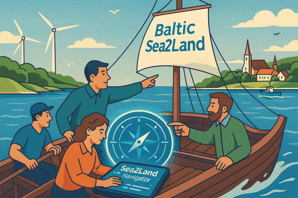
Navigating Together: How Baltic Sea2Land Guided Coastal Governance Toward Sustainability
Coastal regions around the Baltic Sea are vibrant spaces where land meets sea – and where planning challenges quickly multiply. Renewable energy, tourism, ecosystem protection and blue economy activities all compete for space, while responsibilities are often fragmented across institutions and governance levels. As project partners described it, coastal planning can feel like steering a ship where everyone rows, but not always in the same direction.
To address these challenges, partners from across the Baltic Sea Region launched the Baltic Sea2Land project. Their goal was to improve coordination at the land–sea interface and help planners navigate the growing complexity of coastal governance.
The project’s key result is the Sea2Land Navigator – a co-created platform designed for public authorities and stakeholders involved in coastal and maritime spatial planning. The Navigator is more than a tool – it’s a co-created platform built on real-world experience. It combines three powerful components:
- Data Hub – access spatial data, interactive maps, and visualizations for informed decisions.
- Knowledge Hub – explore terms, methods, and best practices for integrated planning.
- Multi-Level Governance (MLG) Tool – practical tasks and guidance for collaboration across levels and sectors.
Together these components help planners balance environmental, social and economic interests and fosters collaboration across levels and sectors during various planning stages.
To test the approach, partners carried out pilot activities in six Baltic Sea countries. These pilots addressed real planning challenges – from developing a roadmap for coastal energy self-sufficiency in Germany to improving inclusive coastal planning processes in Estonia and Latvia. Through these experiences, planners, authorities and stakeholders learned how shared knowledge, transparency and collaboration can lead to better decisions and more balanced coastal development.
Pilots: Learning by Doing
Our journey was shaped by pilots across six countries, each testing new approaches:
- Germany (Fehmarn) – developed a roadmap for energy self-sufficiency and improved stakeholder engagement in renewable energy planning. “Energy transitions are marathons, not sprints.”
- Estonia (Saaremaa) – co-created a thematic coastal access plan with local communities, proving that “Transparency and inclusion are not just ideals– they are practical tools for better planning. The beauty of this project is its inclusiveness. Fishermen, tourism operators, and planners now sit at the same table.”
- Poland – promoted “energy citizenship” through workshops and interviews, building local ownership of offshore wind projects. “Baltic Sea2Land showed that borders don’t matter when it comes to protecting our coasts. Cooperation is the real game-changer.”
- Latvia – linked regional and national planning through a Coastal Thematic Plan and evaluation of the National Coastal Plan. “For years, we struggled with fragmented planning. The Navigator finally gives us a common language and tools to work together.”
- Finland – integrated blue-green infrastructure into MSP and invited students to shape future planning strategies. “The future of planning is already here – and it’s collaborative, creative, and cross-generational.”
- Lithuania (Klaipeda) – developed monitoring and evaluation systems for MSP, informing the Blue Data Dashboard now featured in the Navigator.
These pilots were not isolated – they were connected through shared tools, peer learning and a common commitment to better governance.
The 4th Mission Arena event on April 2025, in Sopot, culminated in the co-creation of a Roadmap guiding the region toward achieving the goals of EU Mission Oceans & Waters. Participants voted on the top actions to be taken in the South Baltic region to improve the circularity and sustainability of the blue economy. One of them was the Governance theme, many specific and practical actions were suggested and voted on by participants. The action that received the most votes was: “Promote co-creation and collaboration among practitioners. Improve communication, engagement, and strengthen multi-level governance between stakeholders by establishing a common platform to exchange practices and lessons learned”. This action was originally formulated during a workshop organized by the Baltic Sea2Land partnership. It was a meaningful acknowledgment that our emphasis on enhancing and actively practicing a multi-level governance approach – which applied throughout the implementation of the Baltic Sea2Land project – resonated strongly with a diverse group of participants.
Impact and What’s Next
The Sea2Land Navigator is now live (explore it here) and recognized as a model for transnational cooperation. It supports planners in navigating complex LSI challenges and will continue evolving through new Interreg BSR platform projects like SEABAS and Baltic PlaNet. We are also proud that the Sea2Land Navigator has been included in the Esri ArcGIS Hub Gallery – the official platform showcasing solutions from around the world built on ArcGIS technologies.
To ensure lasting impact, we are launching a Massive Open Online Course (MOOC) to build capacity and share lessons learned. The Navigator will remain a resource for those charting the future of maritime spatial planning in a changing world.
Keywords from the Navigator team
For Stakeholders: Be bold and use the Navigator!
For planners: Be a game changer and use the Navigator!
For policy makers: Improve policy and use the Navigator!
Sea2Land Navigator – Your Compass to Unlock Planning Insights!
Video about the use of the Sea2Land Navigator: https://www.youtube.com/watch?v=l-xxyhFfz-o

Additional links
details
-
Homepage
-
Project typeCore Project

-
ImplementationJanuary 2023 - December 2025
-
StatusCompleted
-
Contribution to EUSBSRPolicy Area Spatial Planning

-
Target groups
- International governmental organisation
- Local public authority
- National public authority
- NGO
- Regional public authority
-
Social media
-
Additional links
-
Tags