

Baltic Sea2Land piloting experiences: sharing main insights and lessons learned
21 February 2025
The end of year 2024 also marked the end of Baltic Sea2Land piloting phase. What are the main highlights and lessons learned from the piloting in different Baltic Sea region countries? How did the Sea2Land Navigator – the main solution that is being developed within the project – assist piloters in their work? Read the article to find out!
Latvia
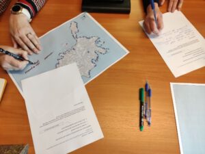
Latvian Baltic Sea2Land team conducted two distinct yet interconnected pilot projects on regional and national levels. The regional pilot focused on developing a Coastal Thematic Plan for the Kurzeme region, while the national pilot centered on the National Coastal Plan.
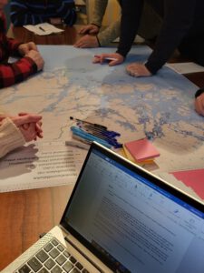
During the piloting phase, the regional team undertook extensive efforts to engage stakeholders from various levels and representing diverse interests. Several workshops and working groups were organized, involving over 250 participants. Highlighting lessons learned, the team emphasized the challenge of finding the right focus and approach in an area as multifaceted as the coast, which intersects numerous interests, sectors, and conflicts. Effective stakeholder engagement was deemed crucial due to the involvement of local, regional, and national levels, spanning tourism, environmental concerns, cultural heritage, blue economy sectors, housing, and public infrastructure. Another challenge that was identified by Kurzeme Planning Region team is that there is ongoing planning at both local and national levels, underscoring the risk of stakeholder fatigue.
The national pilot case was closely linked to the interim assessment of Latvia’s Thematic Coastal Plan. While the primary task was to evaluate the impact of public infrastructure on coastal development, the introduction of the MLG approach broadened the scope to include blue economy, mobility, nature and environment, and social capital alongside tourism. These topics were discussed during workshops and site visits in coastal municipalities, focusing on the concept of good coastal living. The piloting phase also helped identify gaps and challenges in coastal planning. One key issue highlighted by stakeholders was there is a the lack of strategic coordination among sectors, resulting in fragmented planning and limited shared understanding across different areas of development.
Additionally, a coastal landscape assessment was conducted during the pilot phase, yielding valuable insights into landscape values and specifics pertinent to both national and regional pilot cases.
Both Latvian pilot cases tested the Sea2Land Navigator tool, each using it in different ways. The regional pilot explored the multi-level governance (MLG) approach in greater depth, with the team concluding that the tool was a valuable source of inspiration and new knowledge. Meanwhile, the national pilot used the Navigator to broaden the scope of the Coastal Plan assessment, incorporating additional themes for re-evaluation and future integration into coastal and maritime spatial planning and management. Additionally, the Data Hub provided essential information for landscape mapping, further supporting the planning process.
Overall, the pilot phase has laid crucial groundwork for the successful development of the Kurzeme Region Coastal Thematic Plan, facilitating justification and advocacy at the national level for continued investment and coastal development solutions. Whereas the national pilot has gained valuable insights for future spatial planning strategies, especially, land-sea interactions and integration with the Latvian Maritime Spatial plan.

Estonia
Estonia is represented in the Baltic Sea2Land project through the Saaremaa pilot case, which focuses on harmonizing land and sea planning at the local level. During the pilot phase, the Saaremaa team worked to establish a supportive framework for integrated coastal land use and marine space planning, considering sustainable blue economy perspectives and community values.
Key activities included stakeholder workshops, participatory GIS mapping, surveys, and interviews, all of which provided crucial insights into land use conflicts and community priorities. One major lesson learned was that coastal accessibility is a complex issue requiring a careful balance between private land ownership, public access, environmental protection, and community needs.
In this pilot, the Sea2Land Navigator was used for situation scoping, sectoral mapping, and stakeholder analysis, helping to streamline data collection and identify accessibility challenges. However, the team found that some Navigator tools were too complex for local staff. This valuable feedback will help developers refine and improve the tool for future use. Despite these challenges, integrating existing municipal tools with the Navigator enhanced planning and decision-making processes.
For Saaremaa, the work does not end with the pilot phase. The results will be now incorporated into the island’s new comprehensive plan, ensuring that coastal accessibility principles are formally adopted. Public participatory planning efforts will also continue, reinforcing community involvement in shaping Saaremaa’s coastal future.
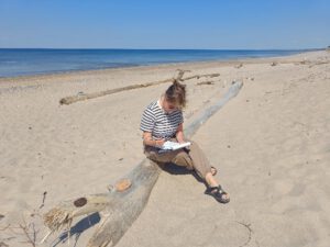
Autor: Anu Printsmann, picture taken from a stakeholder seminar workshop
Lithuania
Lithuania’s pilot case is Klaipeda region, which focuses on developing a monitoring and evaluation system for the Klaipeda Region Specialization Strategy 2030 and analyzing the economic performance of the maritime sector.
During the pilot phase, the Klaipeda team engaged stakeholders through meetings to refine the monitoring and evaluation system while also reviewing the strategy itself and the measures outlined in 2021. A key lesson learned was that continuous stakeholder involvement is essential for successful strategy implementation. Engaging stakeholders in both execution and monitoring fosters a sense of ownership, making the strategy more adaptable and resilient. Additionally, the team emphasized that keeping the strategy practical and easy to integrate into daily tasks is crucial to ensuring its long-term success.
The Sea2Land Navigator supported the pilot case in several ways. The MLG tool was tested to develop the monitoring and evaluation system, with its frameworks assessed in practice during stakeholder discussions on maritime economy measures. Additionally, a Blue Data Dashboard (for the Data Hub) was created to analyze integrated approaches, economic performance, and Klaipeda Region’s role in the sustainable blue economy.
Also for Klaipeda the work does not end here. The monitoring and evaluation system currently exists only in a paper-based format, but efforts are underway to develop a digital platform for tracking maritime economy results. Furthermore, the lack of a national maritime strategy in Lithuania remains a challenge for effective planning and analysis. To address this, the team is actively engaging with the newly elected parliament to highlight the need for a comprehensive maritime strategy, ensuring sustainable growth and informed decision-making in the sector.
Finland
Several pilots were conducted in Finland under the Baltic Sea2Land project, focusing on the promotion of the Coastal Strategy and on different aspects of maritime spatial planning (MSP). These included the Archipelago Sea Pilot, which engaged stakeholders to assess the water impacts of renewable energy development, particularly solar energy, and the Kymenlaakso Pilot, which evaluated stakeholder understanding of the blue-green map designation and its regional promotion. The National Pilot built upon the Kymenlaakso findings to explore the feasibility of adding a blue-green infrastructure marking to the national maritime spatial plan, while the Northern Planning Area Pilot assessed how MSP can better consider migratory fish and potential conflicts with offshore wind power expansion.
To achieve these goals, stakeholder workshops were central across all pilots. Many stakeholder involvement events were held, e.g. Northern Planning Area Pilot (Northern Bothnian Sea, Quark and Bothnian Sea) focused on fisheries, had several stakeholder events assessing the effectiveness of current MSP markings and identifying potential conflicts, especially with offshore wind development. Within the Kymenlaakso case a workshop focusing on the promotion of the blue-green infrastructure map marking from stakeholder perspective was organized. The work was continued in a second workshop where problem areas, identified in the first workshop, were handed over to landscape architect students who then created visions for these areas in support with the stakeholders. Archipelago Sea pilot focused on engaging stakeholders and gathering knowledge on the water impacts of renewable energy development in the Archipelago Sea catchment area.
The Navigator provided valuable support to the diverse Finnish cases too. The Navigator’s MLG tool helped identify key sectors and stakeholder groups, ensuring broad and inclusive participation. It also provided a framework for analyzing internal working methods and documents, clarifying stakeholder interconnections, and refining workshop methods to ensure insights effectively informed decision-making.
Each pilot case contributed valuable insights on the chosen planning question:
- The Archipelago Sea Pilot highlighted the need for multi-stakeholder engagement in assessing cumulative environmental impacts of water management decisions.
- The Kymenlaakso Pilot revealed that while land-use planners understood the blue-green map designation, better communication was needed for other stakeholders.
- The National Pilot demonstrated how the MLG tool improves internal processes and fosters cross-sectoral planning.
- The Northern Planning Area Pilot reinforced the importance of collaboration, uncovering new data and validating existing plans to support migratory fish conservation and cross-border cooperation.
The Finnish team will continue advancing sustainable MSP. The Archipelago Sea Pilot’s findings will contribute to an energy-focused regional land-use planning process that incorporates water impact considerations. Insights from the Kymenlaakso Pilot will support the development of a national blue-green infrastructure map designation. Discussions from the National Pilot will continue into 2025 regarding the integration of blue-green infrastructure into Finland’s revised maritime spatial plan. Lastly, the Northern Planning Area Pilot’s results will be integrated into the national MSP update, enhancing considerations for fisheries and the marine environment.
Overall, these pilots have strengthened Finland’s MSP by enhancing stakeholder engagement, refining decision-making processes, and promoting environmental sustainability in coastal and marine areas. The insights gained will continue to shape future MSP updates, ensuring more resilient marine ecosystems and coastal communities.

Germany
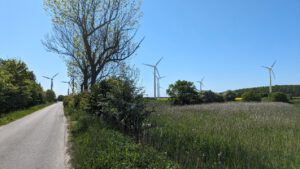
The German pilot is focused on renewable energy and energy autonomy in Fehmarn island.
During the pilot phase, a stakeholder survey on renewable energy was conducted, gathering insights from residents, businesses, and tourists on wind energy perceptions. These findings will help inform local policies and decision-making. At the same time, legal experts were involved to navigate complex EU and national regulations, assessing the feasibility of local energy autonomy for Fehmarn.
A key lesson learned was the importance of sectoral mapping, which helped identify both synergies and conflicts between different sectors—such as the impact of transportation on tourism and the environment—clarifying Fehmarn’s economic and social interconnections. Additionally, tailored stakeholder engagement methods, particularly leveraging personal connections, proved crucial for gathering information and maintaining momentum when broader outreach was challenging.
The Navigator played a valuable role in this pilot case, particularly in the steps of situation scoping, stakeholder mapping, and action goal setting. It helped guide the development of survey questions specific to Fehmarn’s context, focusing on wind energy’s local impacts. These tools ensured that community feedback was aligned with actionable energy goals.
The work done during piloting laid an important groundwork for further steps towards renewable energy goals. The next steps involve replicating successful practices in new regions, building on Fehmarn’s progress in energy autonomy. The team plans to extend good practices to other small municipalities in Schleswig-Holstein and Mecklenburg-Vorpommern, particularly focusing on local or regional renewable energy-based heat planning. This initiative will create a replicable framework, amplifying the Fehmarn pilot’s impact and contributing to regional and national climate and energy goals.
Poland
Finally, Poland’s pilot case that involved all Polish coastal municipalities. The goal was to explore coastal communities’ perceptions of offshore wind farms, identify barriers and facilitators for public acceptance, and test analytical tools from the Sea2Land Navigator.
During the piloting phase, the team conducted four workshops, engaging local communities and representatives from various maritime sectors. One of the key methods tested was SWOT analysis from the Navigator toolkit. However, the team observed that participants were sometimes reluctant to use structured tools directly, preferring instead to express their views in open discussions. Nonetheless, these methods proved valuable as conceptual frameworks for designing the piloting process and analyzing the collected data.
Additionally, the Polish team organized three meetings: an internal session with scientists and practitioners from Baltic Sea2Land Polish partners, and two workshops for educators and marine experts. The internal meeting focused on testing the MLG approach and reviewing outcomes from coastal workshops. Expert workshops aimed to complement findings from coastal meetings and compare community expectations with expert perspectives.
Some of the key insights that were identified during piloting exercise:
Firstly, workshops on offshore wind farms perceptions revealed significant misinformation and numerous challenges regarding offshore wind farm investments on the Polish sea. It was concluded that the information and consultation processes are not tailored properly to meet the needs of the coastal communities.
Secondly, the piloting experience showed that the Navigator could benefit from website functionality improvements to make it more accessible and operational for similar stakeholder engagement processes. This feedback will contribute to the next phase of the Baltic Sea2Land project, ensuring the tool is refined for future use.
- Learn more about the Sea2Land Navigator: https://interreg-baltic.eu/project-posts/baltic-sea2land/get-to-know-the-navigator/
- Access the Sea2Land Navigator – a tool designed to assist marine and coastal planners here: https://navigator-helcom.hub.arcgis.com/

Additional links
details
-
Homepage
-
Project typeCore Project

-
ImplementationJanuary 2023 - December 2025
-
StatusCompleted
-
Contribution to EUSBSRPolicy Area Spatial Planning

-
Target groups
- International governmental organisation
- Local public authority
- National public authority
- NGO
- Regional public authority
-
Social media
-
Additional links
-
Tags