




Fields, Water, Thirst for Knowledge - The Nadelitz Learning Site (Germany)
05 March 2026
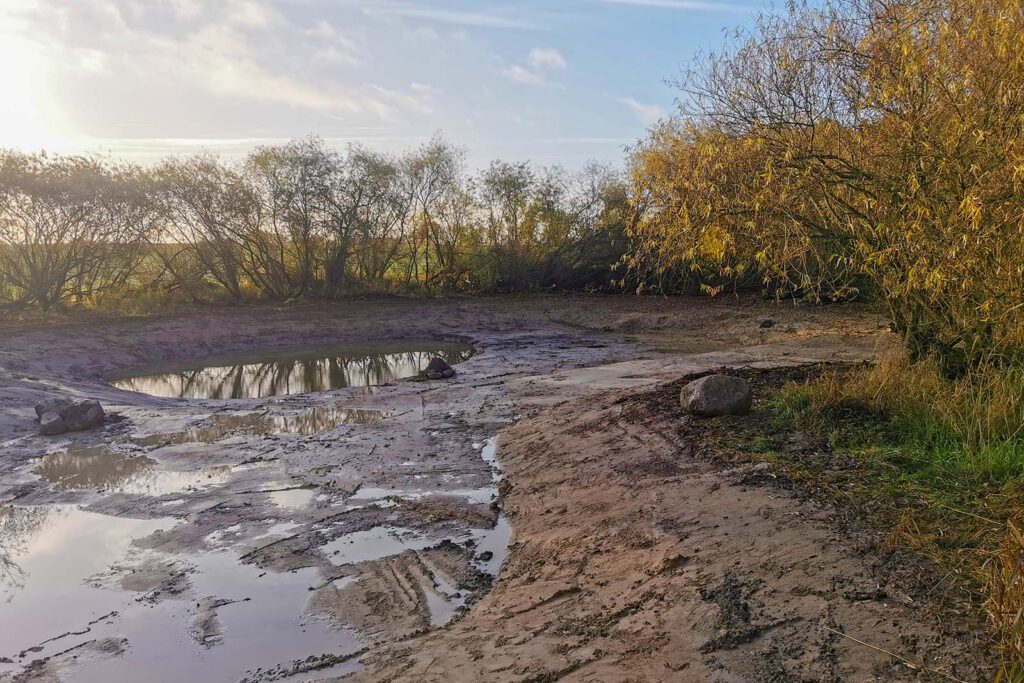
The wetland after dredging. Photo: Southeast Rügen Biosphere Reserve
Key Focus
Accessible educational site with wetland restoration.
Description
The Nadelitz learning Site is located on the outskirts of the village, nestled within a characteristic agricultural landscape. To the north, the area borders an agricultural hall, while the southern and eastern sides are surrounded by active arable land. A paved path to the west connects the village of Nadelitz with Muglitz.
The site features a wide, open water surface framed by a natural border of willow trees. Designed with varying water depths, the wetland provides a specialized habitat for amphibians and diverse aquatic life. Utilizing the natural slope of the surrounding fields, this former depression now functions as a vital ecological buffer and a hands-on educational space where the synergy between farming and nature conservation becomes visible.
From Overgrown Depression to Restored Wetland
The project area lies in a shallow depression surrounded by arable land. For many years, the area was characterised by dense stands of willow, reeds and nettles, reflecting its naturally wet conditions. Although water still collected in the depression during wetter periods, many of the area’s ecological functions had gradually diminished.
Today, restoration efforts aim to re-establish the site’s wetland character by improving natural water retention and creating a wider range of habitats. The project demonstrates how even relatively small landscape features can play an important role in supporting biodiversity and restoring natural processes within intensively used agricultural areas.
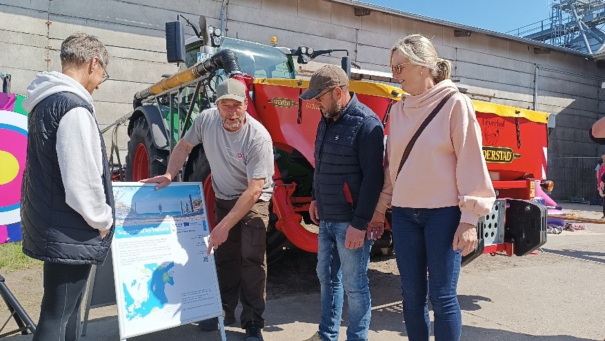
Visitors learning about the project during the Open Day at Agar Zirkow. Photo: Southeast Rügen Biosphere Reserve
A Wetland Surrounded by Farmland
One of the distinctive features of Nadelitz is its location in the middle of an agricultural landscape. To the south and east, the site is bordered by cultivated fields, while a local path connects the nearby villages of Nadelitz and Muglitz. This setting makes the area particularly suitable as a learning site, as visitors can clearly observe the interaction between farming activities and natural ecosystems.
The restored wetland shows how water moves through the landscape, where it is stored during wet periods and how vegetation develops under changing hydrological conditions. It provides a visible example of how wetlands can function as part of a wider landscape rather than as isolated nature areas.
Learning from Other Wetland Restoration Projects
The Nadelitz Learning Site is closely linked to a broader programme of knowledge exchange and stakeholder engagement. Farmers and representatives from the region have participated in study visits to wetland restoration projects in Germany, Sweden and other Baltic Sea countries. These visits have enabled participants to see restoration measures in practice and discuss their experiences directly with landowners and project managers.
The lessons learned from these exchanges have influenced the planning and development of the Nadelitz site, helping stakeholders understand both the practical and ecological aspects of wetland restoration.
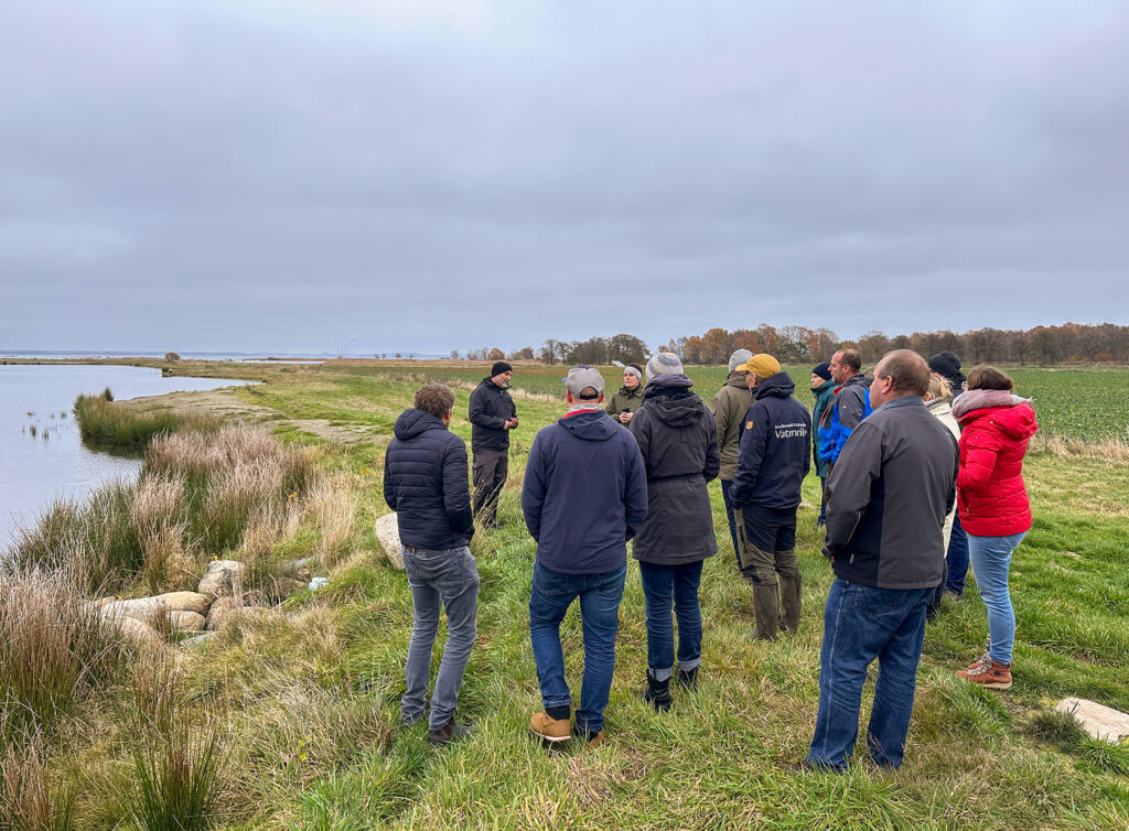
Farmers and representatives from the region in Germany during a visit to Furumo wetland in Sweden. Photo: Martina Adenholm
Built Through Local Dialogue
The selection and development of the site have relied heavily on local knowledge and dialogue. Farmers’ associations, landowners, municipalities, environmental authorities and residents were involved from an early stage in identifying suitable locations and discussing restoration options.
Workshops, meetings and field visits provided opportunities to exchange ideas and address concerns. This collaborative process helped create a shared understanding of the site’s objectives and ensured that local experiences and priorities were reflected in the final design.
Creating Habitat for Plants and Wildlife
As wetland conditions are restored, the area is expected to provide improved habitat for a variety of wetland species. The mosaic of shallow water, wet grassland, reeds and shrubs creates different ecological niches that can support birds, insects, amphibians and aquatic organisms.
The site also serves as an outdoor location where visitors can observe how habitats develop over time. Seasonal variations in water levels and vegetation create changing conditions throughout the year, making the area particularly valuable as a demonstration site for wetland ecology.
A Place for Learning and Demonstration
The Nadelitz Wetland Restoration Learning Site has been designed as an accessible place for learning. Researchers, students, landowners, planners and visitors can explore the site through guided tours, workshops and field excursions.
By bringing together restoration activities and stakeholder engagement, the site provides a practical setting where discussions about wetland management, biodiversity and landscape planning can take place directly in the field. The learning site therefore serves not only as a restored wetland but also as a meeting place for knowledge exchange and long-term collaboration.
Location
Partner
Southeast Rügen Biosphere Reserve Administration
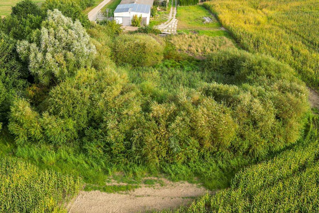
The wetland project area before the measures. Photo: Nico Offermann

Interactive map showing pilot locations. Use the arrow keys to move the map view and the zoom controls to zoom in or out. Press the Tab key to navigate between markers. Press Enter or click a marker to view pilot project details.
Additional links
details
-
Homepage
-
Project typeCore Project

-
ImplementationNovember 2023 - October 2026
-
StatusOngoing
-
Contribution to EUSBSRPolicy Area Nutri

-
Target groups
- Higher education and research institution
- Interest group
- Local public authority
-
Social media
-
Additional links
-
Tags