

In Finland several pilots were conducted
02 December 2025
Several pilots were conducted in Finland under the Baltic Sea2Land project, focusing on the promotion of the Coastal Strategy and on different aspects of maritime spatial planning (MSP). These included the Archipelago Sea Pilot, which engaged stakeholders to assess the water impacts of renewable energy development, particularly solar energy, and the Kymenlaakso Pilot, which evaluated stakeholder understanding of the blue-green map designation and its regional promotion. The National Pilot built upon the Kymenlaakso findings to explore the feasibility of adding a blue-green infrastructure marking to the national maritime spatial plan, while the Northern Planning Area Pilot assessed how MSP can better consider migratory fish and potential conflicts with offshore wind power expansion.
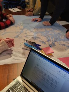
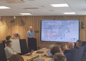
To achieve these goals, stakeholder workshops were central across all pilots. Many stakeholder involvement events were held, e.g. Northern Planning Area Pilot (Northern Bothnian Sea, Quark and Bothnian Sea) focused on fisheries, had several stakeholder events assessing the effectiveness of current MSP markings and identifying potential conflicts, especially with offshore wind development. Within the Kymenlaakso case a workshop focusing on the promotion of the blue-green infrastructure map marking from stakeholder perspective was organized. The work was continued in a second workshop where problem areas, identified in the first workshop, were handed over to landscape architect students who then created visions for these areas in support with the stakeholders. Archipelago Sea pilot focused on engaging stakeholders and gathering knowledge on the water impacts of renewable energy development in the Archipelago Sea catchment area.
The Navigator provided valuable support to the diverse Finnish cases too. The Navigator’s MLG tool helped identify key sectors and stakeholder groups, ensuring broad and inclusive participation. It also provided a framework for analyzing internal working methods and documents, clarifying stakeholder interconnections, and refining workshop methods to ensure insights effectively informed decision-making.
Each pilot case contributed valuable insights on the chosen planning question:
- The Archipelago Sea Pilot highlighted the need for multi-stakeholder engagement in assessing cumulative environmental impacts of water management decisions.
- The Kymenlaakso Pilot revealed that while land-use planners understood the blue-green map designation, better communication was needed for other stakeholders.
- The National Pilot demonstrated how the MLG tool improves internal processes and fosters cross-sectoral planning.
- The Northern Planning Area Pilot reinforced the importance of collaboration, uncovering new data and validating existing plans to support migratory fish conservation and cross-border cooperation.
The Finnish team will continue advancing sustainable MSP. The Archipelago Sea Pilot’s findings will contribute to an energy-focused regional land-use planning process that incorporates water impact considerations. Insights from the Kymenlaakso Pilot will support the development of a national blue-green infrastructure map designation. Discussions from the National Pilot will continue into 2025 regarding the integration of blue-green infrastructure into Finland’s revised maritime spatial plan. Lastly, the Northern Planning Area Pilot’s results will be integrated into the national MSP update, enhancing considerations for fisheries and the marine environment.
Overall, these pilots have strengthened Finland’s MSP by enhancing stakeholder engagement, refining decision-making processes, and promoting environmental sustainability in coastal and marine areas. The insights gained will continue to shape future MSP updates, ensuring more resilient marine ecosystems and coastal communities.


Interactive map showing pilot locations. Use the arrow keys to move the map view and the zoom controls to zoom in or out. Press the Tab key to navigate between markers. Press Enter or click a marker to view pilot project details.
Additional links
details
-
Homepage
-
Project typeCore Project

-
ImplementationJanuary 2023 - December 2025
-
StatusCompleted
-
Contribution to EUSBSRPolicy Area Spatial Planning

-
Target groups
- International governmental organisation
- Local public authority
- National public authority
- NGO
- Regional public authority
-
Social media
-
Additional links
-
Tags