The Interreg project BalticSatApps successfully improved access to EU-based satellite data for entrepreneurs and helped drive new businesses in the Baltic Sea region. Thanks to EU funding, people with smart ideas received support that enables them to further shape our region into a better place to live and work in.
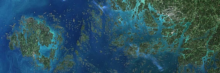
The Archipelago Sea and Åland areas (Finland) © Copernicus Sentinel-2 images (20/07/2019) processed by University of Turku
Availability of EU-based satellite data
The European Copernicus Programme maintained by the European Space Agency (ESA) provides Earth Observation (EO) data free of charge on an open-access basis to European citizens. The Copernicus services are based on satellite and in situ observations, and cater to even near real-time data needs. The services provide global data, which can also be used for local and regional needs.
This data can, for example, help to make visible different phenomena affecting Earth, such as air quality, the ozone layer, emissions, solar radiation, marine safety, urban planning, and forest management. It can contribute to applications e.g. in agriculture and food security, nature conservation, mitigation of climate change, border surveillance, floods, forest fires, and droughts.
Unexploited business potential for Earth Observation (EO) data
Many commercial entities in the Baltic Sea region, especially small and medium sized enterprises (SMEs) could offer new services or enhance their existing services if they used Earth Observation (EO) data. For instance, in the development of carbon-neutral tourism, Copernicus data can give information on the CO2 emissions of a particular area, and the prediction models can be validated with complementing ground monitoring plots.
However, technical barriers may prevent SMEs from fully exploiting the data and information that Copernicus delivers. Not everyone is aware of the possibilities of the Copernicus data either. Furthermore, people might lack knowledge on how to get the desired data from the service, and how to edit it further into the desired form.
Need to bridge gaps in EO data usage
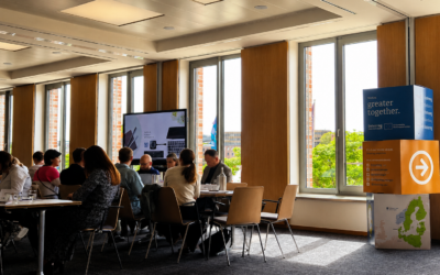
In order to solve these challenges, the Interreg project BalticSatApps organised a series of educational events, innovation generation events, and an acceleration programme to increase interest and facilitate the use of EO in business.
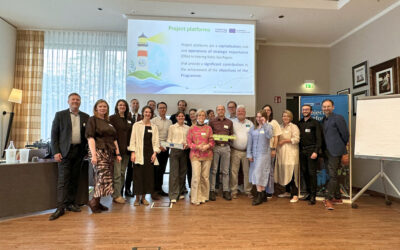
The three-year BalticSatApps project supported the whole chain of developing new services and applications from identifying needs to providing solutions, and from there to commercialisation. The project has been conducted in close collaboration between the project partners from Estonia, Finland, Poland, Russian Federation, and Sweden.
Mapping potential users of EO data
The BalticSatApps project started by approaching in all the partner countries (Estonia, Finland, Poland, Russia and Sweden) the user and developer scene of EO data. Senior Scientist D.Sc. Ali Nadir Arslan from the Finnish Meteorological Institute led these activities, and the research results are made available in the form of EO Market Country Profiles:
“As part of our user uptake activities, we mapped potential users, along with potential and current domain-wise usage of Copernicus data. Furthermore, we conducted a gap analysis by category in order to match EO products and services, both existing and potential new ones, to the needs of industries in the Baltic Sea region. The results show that land, climate change and marine are the most demanded application areas for the users of EO data. In the future, we will see more usage in areas like agriculture, fishery, energy, tourism, natural hazards, and extreme weather events,” he describes.
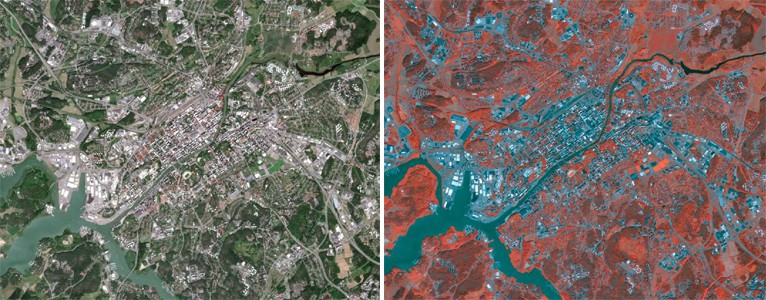
Left side: a “natural colour” composition of a Sentinel-2 image (using visible spectral bands) of the central areas of the City of Turku (Finland).
Right side: The same image in “False colour”, combining visible bands and Near Infrared (NIR) band, here the vegetation appear reddish, as vegetation reflects NIR radiation.
© Copernicus Sentinel-2 images (20/07/2019) processed by University of Turku
Innovation contests, hackathons, and acceleration activities
Based on these findings, the project organised innovation competitions and hackathons in EO. In the heart of innovation events is to get people with different background and set of skills together. BalticSatApps successfully connected people inspired by science, business, technology, design, communications as well as people having personal interest in finding solutions with the help of services based on access and processing of satellite data for various challenge providers.
BalticSatApps held multiple innovation events in Krakow (Poland), Turku and Helsinki (Finland), and Tartu (Estonia). For example, in WeSeaChallenge Turku, BalticSatApps provided real-life challenges related to the planning and monitoring of aquatic activities. All the winning teams of WeSeaChallenge received an invitation to the BalticSatApps acceleration programme.
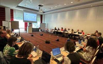
In parallel to conducting innovation competitions and hackathons, the project developed two acceleration programmes in EO and piloted them in Estonia, Poland, and Finland. The programme addressed teams, individuals as well as already established businesses who had a space tech-related business idea. In all, 13 teams were chosen for the Polish, nine for the Estonian, and eight for the Finnish acceleration programme pilots.
“Running the BalticSatApps acceleration programme has provided an excellent opportunity to network with startups and EO experts from the Baltic Sea region. As a result, we will be able to support startup teams working in the EO field to test their business models by involving them in the European Space Agency Incubator activities,” said Andrus Kurvits, member of the Management Board of the Tartu Science Park.
Copernicus data exceeding beyond the EU
The project BalticSatApps successfully involved partners from the Russian Federation within the thematic area of EO. In addition to information and training events arranged there, a Russian interface for Copernicus data was developed. The Interface integrates Copernicus and Russian satellite data sources, and it is possible for anyone to test it with the help of the instructions presented on the BalticSatApps website.
Satellite data inspired new startups
Throughout its duration, the project generated guidelines and info materials to assist other actors in innovation activities focusing on EO. They can be beneficial for application developers interested in EO data, public authorities, research institutions, educational and non-profit organisations, companies, individuals, and various specialists. The commercialisation-related materials can assist science and technology parks, business support organisations, as well as incubators and accelerators.
“We have seen first-hand that EO data and the Copernicus Programme awake a lot of interest among the potential users of the data and the services as well as the solution developers. Through our information and training sessions, we have strived to make tangible opportunities and show that it is not necessarily so difficult to take data and start turning it into information that is useful. We are happy to see all the interest and enthusiasm in EO and how new startups have been formed and their services taken forward with the assistance of BalticSatApps experts,” says the project coordinator Tuomas Ranti from the University of Turku.
Thanks to the acceleration programme, the project has contributed to the founding of ten new start-ups in Estonia, Finland and Poland, and supported them on their way to commercialise the satellite data. The new startups function in areas such as urban planning, agriculture and drones. “We believe that those interested in EO services find the groundwork we have done beneficial, and through adopting our experiences, they can get quickly up to speed with EO development and utilisation. Our results are shared via the website,” says Tuomas Ranti.
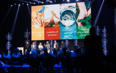
And, indeed, this is what cooperation in Interreg projects is about: about creating an environment for exchanging new experiences and let them become common practice across the region: from the ground up to the sky.
Article by Johanna Aaltonen & Tuomas Ranti, University of Turku
with support of Anna Galyga, Interreg Baltic Sea Region Managing Authority/Joint Secretariat