

Estonia in Saaremaa focuses on harmonizing land and sea planning at the local level
02 December 2025
Estonia is represented in the Baltic Sea2Land project through the Saaremaa pilot case, which focuses on harmonizing land and sea planning at the local level. During the pilot phase, the Saaremaa team worked to establish a supportive framework for integrated coastal land use and marine space planning, considering sustainable blue economy perspectives and community values.
Key activities included stakeholder workshops, participatory GIS mapping, surveys, and interviews, all of which provided crucial insights into land use conflicts and community priorities. One major lesson learned was that coastal accessibility is a complex issue requiring a careful balance between private land ownership, public access, environmental protection, and community needs.
In this pilot, the Sea2Land Navigator was used for situation scoping, sectoral mapping, and stakeholder analysis, helping to streamline data collection and identify accessibility challenges. However, the team found that some Navigator tools were too complex for local staff. This valuable feedback will help developers refine and improve the tool for future use. Despite these challenges, integrating existing municipal tools with the Navigator enhanced planning and decision-making processes.
For Saaremaa, the work does not end with the pilot phase. The results will be now incorporated into the island’s new comprehensive plan, ensuring that coastal accessibility principles are formally adopted. Public participatory planning efforts will also continue, reinforcing community involvement in shaping Saaremaa’s coastal future.
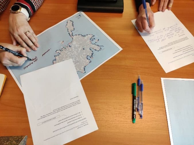
Autor: Anu Printsmann, picture taken from a stakeholder seminar workshop

Interactive map showing pilot locations. Use the arrow keys to move the map view and the zoom controls to zoom in or out. Press the Tab key to navigate between markers. Press Enter or click a marker to view pilot project details.
Additional links
details
-
Homepage
-
Project typeCore Project

-
ImplementationJanuary 2023 - December 2025
-
StatusCompleted
-
Contribution to EUSBSRPolicy Area Spatial Planning

-
Target groups
- International governmental organisation
- Local public authority
- National public authority
- NGO
- Regional public authority
-
Social media
-
Additional links
-
Tags