

The Sea2Land Navigator – a tool designed to assist planners!
16 September 2025
The Sea2Land Navigator – the main outcome of the Baltic Sea2Land project. It is the interactive, step-by-step guide designed to make life easier for planners that helps planners tackle the most pressing questions in maritime spatial planning with the help of its three essential components.
The Sea2Land Navigator platform is available here
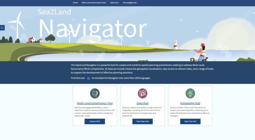
The Sea2Land Navigator has 3 different parts:
- Multi-Level Governance Tool
- Data Hub,
- Knowledge Hub
The MLG (Multi-Level Governance) tool is a structured approach that helps to organize planning processes, improving decision making and stakeholder engagement. It guides you step by step — from analyzing the situation to identifying stakeholders, creating solutions, and tracking progress. It is designed to manage complex cases where different groups and levels of governance are involved.
The Data Hub – Navigator is the central data library for coastal and marine spatial planning. It’s where planners find geographical and economical information, all in one place:
The user can:
- Discover, explore and analyse a vast collection of marine and coastal related geodata. It contains over 200 data layers from a diverse range of topics.
- The Interactive maps section features maps that serve as a communication tool to display spatial context information of potential use for planners.
- Similarly to the Interactive maps section, dashboards presents economic data related to your areas of interest
In the Knowledge Hub section, you can find information in the form of valuable practices, methods and diverse documents. It can improve the planning process and inspire planners to make better choices.
The Sea2Land Navigator does not just help planners create plans; it also contributes to building a sustainable future for the Baltic Sea.
Discover the Sea2Land Navigator and transform your planning processes today!
The Sea2Land Navigator platform
A video has also been produced highlighting the results of the project’s pilot activities and their significance in the implementation of multi-level governance and maritime and coastal planning.
Video of The Sea2Land Navigator: https://www.youtube.com/watch?v=l-xxyhFfz-o
Video of The Sea2Land Navigator in Latvian: https://www.youtube.com/watch?v=ee9L0ufwd1Q

Additional links
details
-
Homepage
-
Project typeCore Project

-
ImplementationJanuary 2023 - December 2025
-
StatusCompleted
-
Contribution to EUSBSRPolicy Area Spatial Planning

-
Target groups
- International governmental organisation
- Local public authority
- National public authority
- NGO
- Regional public authority
-
Social media
-
Additional links
-
Tags