

Baltic Sea2Land solution tool pilot testing in 6 partner countries!
22 February 2024
From the beginning of 2024, testing of the composed Baltic Sea2Land solution – the Sea2Land Navigator tool, is taking place at three different management levels: national, regional, local.
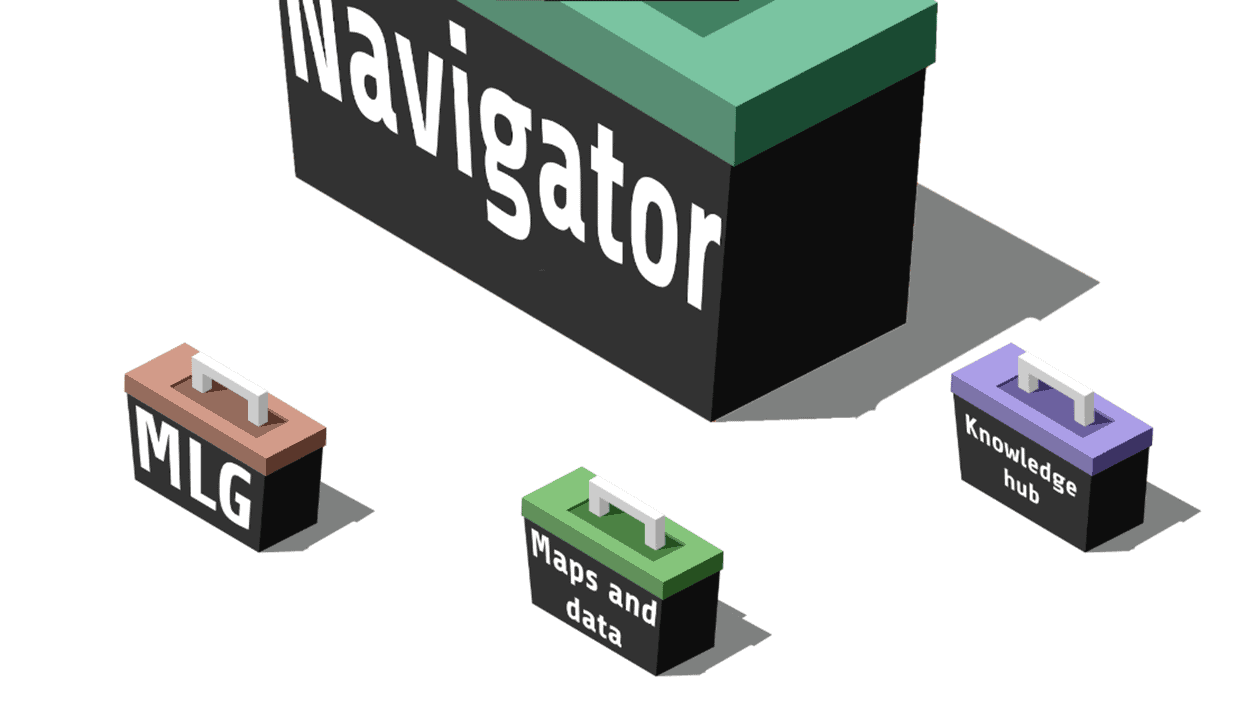
The solution, jointly developed by the project partners, is an online platform created for the purpose of implementing integrated and sustainable coastal planning, as well as for promoting multi-level management. The tool consists of three content blocks:
1) Data Hub: data platform composed of available data relevant for integrated planning of the Baltic Sea coast, incl. maps;
2) Knowledge Hub: a collection of examples of guidelines and valuable practices in the context of coastal planning;
3) Multi-level governance method tool, which offers the user various tasks, allowing to view management processes from a new perspective.
 As the coordinator of the development of the Sea2Land Navigator, the representative of the Baltic Sea Environmental Protection Commission (HELCOM) Secretariat, Manuel Frias, figuratively says that the new Baltic Sea2Land project has set sail to fulfill the dreams of marine and coastal spatial planners:
“Government institutions, together with sustainable blue economy sectors such as fisheries and tourism, can be likened to a sailing boat, where many stakeholders act as the crew of the ship. They must work together effectively to avoid collisions and move towards their intended destination. Smooth sailing through these turbulent waters of land-sea interaction requires a guidance system, or in other words – a navigator.”
Within the framework of the project, six partner countries participate in the testing of the Sea2Land Navigator tool for solving important coastal management challenges:
- Our lead partner the Ministry of Environmental Protection and Regional Development of Latvia (VARAM) is to test the use of the Sea2Land Navigator tool at the national level. The tool will be used in the preparation of the interim assessment report of the Coastal Plan.
- The activity of the project binding to the territory of Latvia also resonates with the development of regional level thematic plan for the coastal areas of the Kurzeme planning region. The institution responsible for its implementation are our partners – the Kurzeme Planning Region.
More information in an article format on the project implementation taking place in Latvia is made available here.
- The South-West region of Finland in cooperation with coastal municipalities applies the piloting in order to update the strategy of integrated coastal management at national and regional scales.
More information in an article format on the project implementation taking place in Finland available here.
- In Poland – the Association of Seaside Cities and Municipalities, for identifying key target groups for the sustainable development of the blue economy and potential tourism resources.
More information in an article format on the project implementation taking place in Poland is made available here.
- In Estonia – Saaremaa municipality, creating solutions to balance the interests of offshore wind farms and coastal tourism.
More information in an article format on the project implementation taking place in Estonia is made available here.
- In Lithuania – Klaipėda region, focuses starting the implementation of the new Specialization Strategy of the Klaipėda region and its monitoring system to observe the impact on a sustainable blue economy in the region.
More information in an article format on the project implementation taking place in Lithuania is made available here.
- In Germany – Fehmarn municipality, for planning solutions balancing coastal tourism, renewable energy production on the island and nature protection.
More information in an article format on the project implementation taking place in Germany is made available here.

Interactive map showing pilot locations. Use the arrow keys to move the map view and the zoom controls to zoom in or out. Press the Tab key to navigate between markers. Press Enter or click a marker to view pilot project details.
details
-
Homepage
-
Project typeCore Project

-
ImplementationJanuary 2023 - December 2025
-
StatusOngoing
-
Contribution to EUSBSRPolicy Area Spatial Planning

-
Target groups
- International governmental organisation
- Local public authority
- National public authority
- NGO
- Regional public authority
-
Social media
-
Additional links
-
Tags